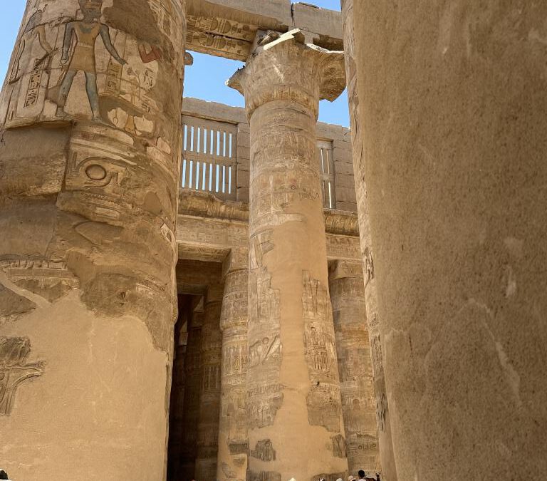
Precise documentation is the backbone of our preservation work at Karnak, and one of the most
essential tools in this effort is planimetry, the art of mapping the site with exactitude. As we explore
the ancient stones of Mastabas 1, 2, and 3, every block becomes a piece of a puzzle, and it is vital that
we record each one’s exact location and condition to ensure its preservation. Over the course of the
mission, our team mapped each stone block, geolocating them with the utmost precision. The
historical French numbering system was present on some blocks, offering insight into the stones’
original arrangement, but many others lacked any form of identification. To remedy this, we carefully
assigned new identifiers to these unnumbered blocks, ensuring that each piece is now traceable
within a digital and physical archive. This effort goes far beyond simple documentation, it creates a
permanent record of the site’s topography, giving us the ability to track changes over time. The
mapping process allows us to visualize the entire site’s layout, spot patterns in the stone
arrangement, and detect areas that might need further conservation or study. It also lays the
foundation for future research, enabling scholars to refer back to these records for comparisons or
reconstructions, particularly when parts of the site may need to be reassembled or restored.
Mapping History; The Power of Planimetry